What We Did
Overview
The agencies that steward Mt. Tam, and the community that loves it, all have a role to play in keeping the mountain healthy and vibrant. To be able to meet this goal, we must first try to answer important questions such as:
- What do we know about how Mt. Tam's plant and wildlife communities and species are doing?
- Do we have a baseline against which we can see and measure change?
- Where do the gaps in our understanding of these resources and the physical and ecological drivers affecting them lie?
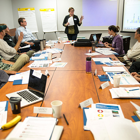
In the spring of 2016, One Tam land management agencies, the Golden Gate National Parks Conservancy, and experts from around the Bay Area came together to share their knowledge and to try to answer the question: How healthy is Mt. Tam?
The resulting findings are thoroughly summarized in Measuring the Health of a Mountain: A Report on Mt. Tamalpais’ Natural Resources. This document also laid the foundation for the condensed summary, Is Mt. Tam in Peak Health? and this website.
This guide has since been created for agencies interested in carrying out similar work.
Defining the Health of Mt. Tam
For the purposes of this assessment effort, the health of the mountain was defined as:
- Mt. Tam’s ecosystems are resilient (able to function/recover despite disturbances, changes, or shocks).
- The full complement of plants, animals, and other life forms are present, can reproduce, and are able to find food, shelter, and water as long as climate conditions allow them to persist on Mt. Tam.
- Natural processes occur in a manner and frequency considered “normal” either based on historical evidence or the ability to maintain ecological functions and adapt under changing climate conditions.
The Health Assessment Process
Determining how to measure the health of the mountain’s resources required a collaborative, iterative, and multidisciplinary approach. The process was led by the Health of Mt. Tam’s Natural Resources Advisory Committee—a team of natural resources staff and ecologists from the One Tam partner agencies, the Golden Gate National Parks Conservancy, and Point Blue Conservation Science.
The Advisory Committee followed a methodology similar to that used by the National Park Service for its Natural Resource Condition Assessments (NRCAs). Like NRCAs, this effort used existing information to assess trends and conditions, confidence levels, stressors/threats, and critical information gaps. The depth and breadth of the resulting assessments reflect the varying levels of currently available data and expert opinion on each indicator.
Not every biological community type or plant or animal species on Mt. Tam was included in this health assessment process. Good indicators are measurable, have low amounts of data “noise,” and reveal things about other aspects of ecosystem health. They also met one or more of the following criteria:
- It is present in the One Tam area of focus.
- There is existing information available and/or expert opinion to draw upon to try to determine its condition or trends.
- It is useful for measuring the health of the mountain in some meaningful way (e.g., an indicator of biological integrity and biodiversity, natural disturbance regimes, or habitat quality).
- It is a threatened, endangered, or rare species that if lost would have an impact on the mountain’s health by the above definitions.
- It is especially iconic or charismatic, can be used to build public affinity and interest, and/or can be used as to help gauge the health of the mountain by the above definitions.
Engaging the Broader Scientific Community
A thorough assessment of existing information, data, and reports was done for the preliminary list of ecological health indicators. This information was then distilled into summary worksheets that were used as the basis for three workshops:
- A day-long workshop on February 5, 2016, which was attended by approximately 40 natural resource staff scientists from all One Tam partner organizations, as well as some staff from Point Blue Conservation Science, the National Park Service Inventory and Monitoring Program, and Point Reyes National Seashore
- Another day-long gathering on February 10, 2016, which focused solely on potential bird species and guilds as indicators of health, ecological stressors, and landscape-scale processes
- A two-day workshop on March 10–11, 2016, which brought together 60 local and agency scientists to consider the remaining (non-bird) indicators
Participants were broken into facilitated, taxonomically based groups to review the existing information, discuss the current state of agency knowledge and data sources, identify information gaps, and provide feedback on the list of proposed indicators, metrics, and condition and trends assessments.
They relied upon a wide array of background materials including agency reports and data sets, published papers, and gray literature; however, where data were scarce or nonexistent, participants were asked to use their best professional judgment to try to make a statement about goals, conditions, and trends for the proposed indicators.
A subset of the initially proposed indicators was selected based on these discussions and the feedback gathered at the workshops. These indicators were deemed good representatives of the health of Mt. Tam, and they had sufficient information or opinion consensus to set metrics and assess condition and trends. These are the indicators included in Measuring the Health of a Mountain: A Report on Mt. Tamalpais’ Natural Resources and on this website.
The 2023 Update
In 2023, we published an update to the 2016 effort that considers changes to the mountain’s health: Peak Health: An Update on the Status of Mt. Tamalpais’ Ecosystems. Fortunately, the original report provided a solid foundation on which to base this update, so we did not have to repeat the original lengthy and involved process. Rather, subject-matter experts—some of whom contributed to the 2016 report, some who were new to the project—reviewed and updated each chapter based on their latest data and field observations.
Using what we have learned since 2016, this update refines our original choices and adds new material. For example, we have new data on the expected effects of climate change as well as what we can learn from crowd-sourced data such as iNaturalist. In some cases, no data had been collected, leading to a decision to drop a metric for a particular indicator. In others, new data have allowed us to add indicators that we could not include in 2016 (e.g., bats, bees, and the California giant salamander [Dicamptodon ensatus]). A new, countywide vegetation map became available in 2018, providing a much more detailed and comprehensive view of the mountain’s plant communities. While this allowed for a better analysis of their health, it also complicated measuring change over time against the old data (and assumptions made in the absence of data for some areas). Likewise, a corollary forest health strategy completed in 2023 offers opportunities to align this project with its much more in-depth dive into those communities.
Ultimately, what we learned is that as nature is dynamic and adaptable, so must be any effort to measure its health over time.
Looking Ahead
One Tam partners are committed to keeping a pulse on the mountain's overall health and sharing what we're learning with the community. We are currently looking at how and when to share out the next update as we continue to evolve this effort.